Cooperation / International activity
The scientific and research staff of the department is constantly expanding scientific cooperation with scientists of both Ukrainian and foreign universities and organizations:
- State Agency of Forest Resources of Ukraine;
- Ukrainian Research Institute of Forestry and Agroforestry G.M. Vysotsky;
- Ukrainian Scientific Research Institute of Mountain Forestry P.S. Pasternak;
- DKP "Kyivzelenbud";
- IIASA, Laxenburg, Austria;
The research project "Impact of forest fires on the carbon cycle in forest ecosystems", which became one of ten projects selected by a joint intergovernmental commission for implementation in 2021-2022. Continue the strategic partnership with the research group of the International Institute for System Applied Analysis (IIASA, Austria) represented by project manager Dr. Florian Kraxner and leading scientists of the institute, professors Anatoly Shvidenko and Dmitri Shchepashchenko. The most important task for the project is to support the research of graduate students and young forestry scientists for the improvement of applied solutions for the management of forest ecosystems in conditions of increased risks of natural disturbances due to climate change.
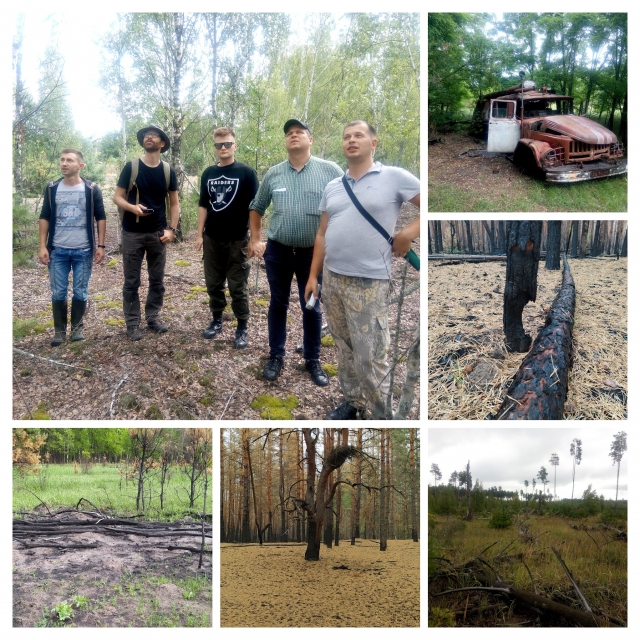
As part of the Ukrainian-Austrian project, the problem of modeling forest fires was solved, applied approaches to mapping fires based on Earth remote sensing data were developed, and the practical implementation of carbon emission assessment due to the impact of forest fires was provided. During the research work, an analysis of the dynamics of landscape fires on the territory of Ukraine was carried out with a focus on the Chernobyl Exclusion Zone. The system for modeling the risks of fires in the Chernobyl Exclusion Zone has been improved, which allows predicting the probable points of occurrence of large forest fires. Improvement of methodological support for modeling the behavior of forest fires, mapping of landscapes affected by fires, based on the creation of new technological solutions in the field of remote sensing of the Earth, made it possible to create a basis for determining carbon emissions due to the burning of forest biomass and increase the effectiveness of fire prevention.
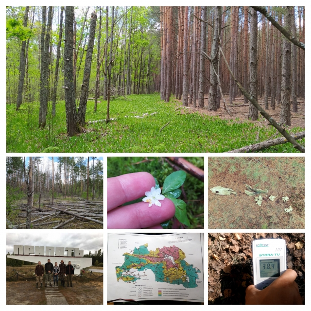
Joint Ukrainian-Belarusian research project "Mapping radioactively contaminated forest ecosystems within Ukraine and Belarus" (Mapping radioactively contaminated forest ecosystems within Ukraine and Belarus) in cooperation with the Institute of Radiobiology of the National Academy of Sciences of Belarus. As part of the implementation of the project, mapping of the forest cover was carried out based on the data of remote sensing of the earth with an assessment of the content of radionuclides in the forest biomass. On the basis of the obtained materials, a research database was created on the transition of artificial radionuclides from the soil to the phytomass components of young forests with the possibility of further assessment of the contamination of stands on the territory of the entire Polissia, where natural successions are observed on abandoned agricultural fields. The obtained mapping materials of the spatial distribution of radioactive pollution in the area of interest will allow to more accurately predict the potential emission of radionuclides during landscape fires in the future, and therefore to improve management decisions in the field of fire prevention. The portfolio of ecosystem services of the forests of the Chernobyl Exclusion Zone and the Polissky State Radiation and Ecological Reserve is provided with additional scientifically based data for their further use in the priority areas of socio-economic development of the countries.